
Page 12 - Alabama 811 Magazine 2021 Issue 2
P. 12
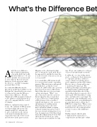
What’s the Difference Bet
And if there is a difference, whose fault is it that many of us in the field don’t really know the difference? It can’t be JUST our fault. As excavators and locators, what we know about such things are, for the most part, what
the sales force and GIS or mapping personnel have told us.
I recently asked Matt Brown, the Operations and Technology Director for Alabama 811, a friend and great resource to tell me in lay terms the difference
if there was a difference. He said, “Simply put, a GIS program is designed to give answers to spatial questions as opposed to mapping which is created for display.”
Still more explanation was required for me. He continued, “A GIS program excels in tracking and tracing. An example would be to show me the location of all valves in the system
or show me how many times we’ve repaired the water line between 2nd and 3rd Street in the past ten years.
Mapping on the other hand is what we’re accustomed to in the field. Here’s the map and it looks like the water line is on the west side of the street, you can see for yourself.”
So, it sounds like a GIS system would be of tremendous benefit to any utility manager. Why isn’t it more widespread? Naturally, there are likely several reasons. It could be that some operators have invested money in a GIS system, but feel they have not gotten a return on their investment. “Why?”, you
ask. Some say because the operators haven’t taken the time to learn how
to use it. There is no doubt but that
a GIS system provides a wealth of valuable information to the operators and managers of a utility system. Unfortunately, much of the value
has been hidden behind acronyms, technical terminology, and a cloud of disconnect from how things have been done for many years. I don’t know how much Albert Einstein knew about GIS and such, but I do know one of the more famous quotes attributed to him
was, “If you can’t explain it to a six-year- old, you don’t understand it yourself.”
Possibly, the cost of providing survey grade coordinates for their system was too expensive and they couldn’t see
a way to budget for both the survey grade equipment and the GIS Software. Here is some good news and in easy- to-understand terminology. The technology has improved and the price for implementing a full-blown GIS system has drastically reduced. Also, did you know that you can now collect survey grade GPS data with a locating device and upload it to your maps? In the next issue of the 811 Magazine, we’re including an article on an amazing pilot program that features a Vivax vLoc3 RTK-Pro locating device. This receiver is a game changer, in that your locator in the field can collect and upload the accurate location of the utility just located.
Finally, it may be that the plan
to implement the system was too comprehensive and they just couldn’t
10 • Alabama 811 2021, Issue 2
